dcr
Deceased Member
Registered: February 2004
Posts: 1,317

|
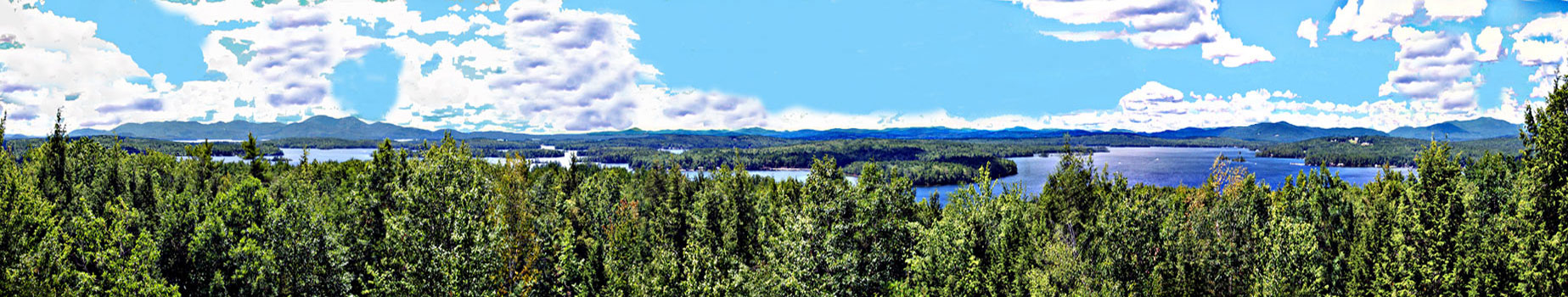
The right half of the photo features Moultonboro Bay. At the far right is Sandwich Dome. To its left, partially in shadow, is Mt Israel. Looking a little further left, across Melvin Bay, you can see openings on a small hill, parts of the Bald Peak golf course. A little to the left of that and further back is Red Hill. A line that just misses Garnet Point, on the south side of Moultonboro Bay, leads you to Smarts Mt, on the horizon. Follow a line past the S tip of Moultonboro Neck, and across Long Island, to the horizon to see Mt Kearsarge, 35 mi to the SW. A line across Cow Island leads to Belknap & Gunstock Mts, 11.5 mi distant. A line across Tuftonboro Neck to Mt Major crosses the just visible top of Rattlesnake Island.
|


 Winnipesaukee Forum