Home Forums Gallery Webcams Blogs YouTube Channel Classifieds Calendar Register FAQDonate Members List Today's Posts

  Home · Search · Register  

Home » Scenic Views Previous image   Slide Show   Next image
more
3-31-07_Roberts_Cove.jpg
628Thompson_Deck_Boat.JPG
Ossipees_from_Roberts_Cove_Rd_2.jpg
9DSC03305-1024w.jpg
Nickerson_Mts.jpg
more

The Ossipees from the Hopewell Rd
Click on image to view larger image


Photo Details
dcr


Deceased Member

Registered: February 2004
Posts: 1,317
users gallery
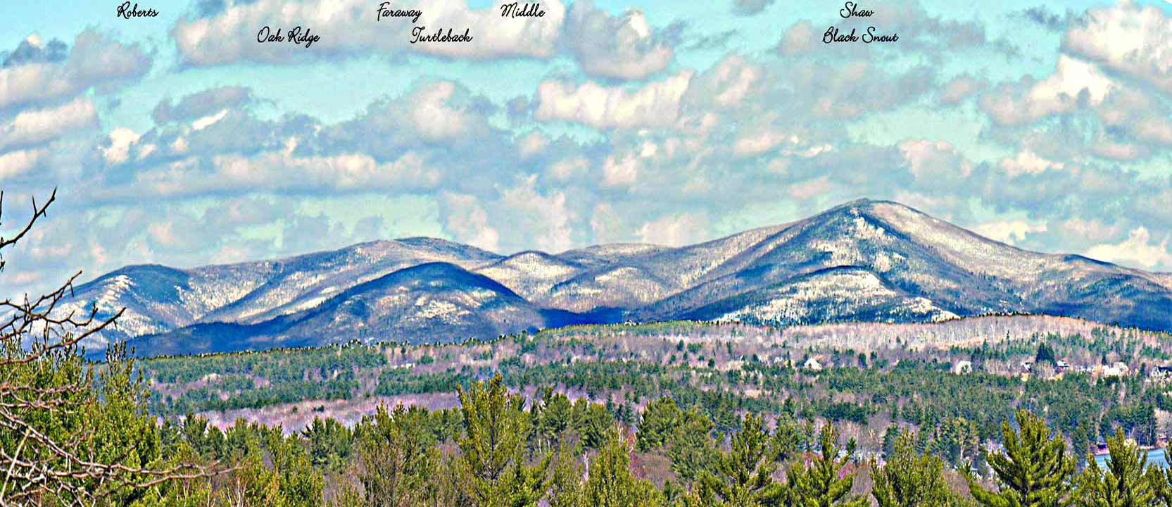
Most of the Ossipee Range which is visible in this photo is protected land of the Castle in the Clouds property, including the full extent of the ridgeline that forms the horizon. Some of the land which forms the lower slopes in the right half of the picture is land in private hands. All of the named summits are on Castle property.
· Date: Fri April 14, 2006 · Views: 5161 · Filesize: 32.0kb, 182.0kb · Dimensions: 1665 x 720 ·
Additional Info
Print View
Linked Thumbnail:  more


Author
Thread  
ApS

Senior Member

Registered: January 2005
Location: Florida (Sebring & Keys), Wolfeboro
Posts: 5,938
Tue February 2, 2010 10:39am

The prominence directly below Black Snout and Mt. Shaw is Brier Hill.


There is a Hopewell Point Road on Wolfeboro Neck—named for the late developer.

------------------------------
Is it
"Common Sense" isn't.
This user is offline
Click here to see this users profile Click here to Send this user a Private Message Visit ApS's homepage! Find more posts by this user Visit this user's gallery  


Photo Sharing Gallery by PhotoPost
Copyright © 2007 All Enthusiast, Inc.


All times are GMT -5. The time now is 05:10 PM.


Powered by vBulletin® Version 3.8.11
Copyright ©2000 - 2025, vBulletin Solutions Inc.