

|
|
|
|
|
|||||||
| Home | Forums | Gallery | Webcams | Blogs | YouTube Channel | Classifieds | Calendar | Register | FAQ | Donate | Members List | Today's Posts | Search |
 |
|
|
Thread Tools | Display Modes |
 05-27-2013, 05:20 PM
|
#1 |
|
Junior Member
Join Date: Jul 2012
Posts: 4
Thanks: 2
Thanked 3 Times in 3 Posts
|
Can anyone tell me who is in control of the Dam in Lake Port? And why is it closed with the lake so over full?
I don't understand why they keep it high in the spring so alot of boaters can not get on the lake and they drop it so early in September and drive boaters of the lake when there is another good month of boating. |

|

|
| The Following User Says Thank You to Peck For This Useful Post: | ||
Lakegeezer (05-27-2013) | ||
|
05-27-2013, 05:39 PM
|
#2 | |
|
Senior Member
Join Date: Jun 2008
Location: Portsmouth. RI
Posts: 2,231
Thanks: 400
Thanked 460 Times in 308 Posts
|
Quote:
 ..NB ..NB
|
|
|
|
|
|
05-27-2013, 05:44 PM
|
#3 |
|
Senior Member

Join Date: Jan 2006
Posts: 6,700
Thanks: 751
Thanked 1,454 Times in 1,011 Posts
|
They worry about the people downstream from us.
|
|
|
|
|
05-27-2013, 05:58 PM
|
#4 |
|
Senior Member
Join Date: Oct 2010
Posts: 2,028
Thanks: 603
Thanked 687 Times in 425 Posts
|
It's a long story, but here it is:
Lakeport Dam at Lakeport Water Level and Flow Constraints: June 1 through Columbus Day (Summer Recreation Season) To the extent that weather conditions allow, levels are managed between 504.32 and 502.80 to facilitate the use of the lake for recreational enjoyment. Depending upon events and forecasts lake levels are allowed to climb to 504.80 (about 6 inches above full) for short periods of time to allow discharges at Lakeport to be managed to alleviate or lessen downstream flooding/flood peaks and to avoid exceeding the capacity of downstream hydropower plants. Currently, a considerable amount of judgment is applied when making decisions regarding flow release during these high water periods. Since the wasting of water in excess of the hydropower capacity at Lakeport Dam (1,050 cubic feet per second (cfs)) is of concern, the decision to do it is based upon factors such as: rate of rise (inflow), soil moisture condition, basin vegetation status, precipitation forecast and estimated length of time to return levels to within the normal range. When levels reach 504.50+/-, the number of complaints regarding shoreline structure damage or usability increases. This 71-square-mile lake has hundreds of permanent and seasonal homes with varying degrees of shoreline development When the level rises much above the full pond level of 504.32, impacts begin to occur. There is at least one marina that experiences problems with bridge access (low clearance) when levels begin to climb above full. Issues associated with the lower end of the summer recreation range relate to hull/motor damage to boats and, like high water, to structure usability. Many abutters are accustomed to a certain range of water levels during the recreation season. However, when the lake is at the lower end of the range, docks and other structures may become less accessible (ex: hull draft is larger than depth at dock). The 250 cfs minimum outflow at Lakeport Dam can sometimes far outpace inflow during the summer recreation season and this, combined with normal summer evaporation, will cause the lake level to typically drop 12 to 15 inches over the course of the summer. Columbus Day through December 31st To the extent that weather conditions allow, the lake level is managed between elevations 503.00 and 503.50 during this period by releasing water at a rate that can be fully utilized by the downstream hydropower plants (250 to 1,050 cfs). This is done to facilitate shoreline property maintenance. If deemed appropriate, and based upon basin conditions and weather forecasts, levels will be allowed to climb above this range to prevent releases at Lakeport from exceeding 1,050 cfs. When the level begins to encroach on the full summer elevation (504.32), releases will be increased beyond the capacity of the hydropower plants to make lowering the lake level the first priority. DES also endeavors to reach a target level of approximately 502.80 on December 31st, which is approximately six inches above the full drawdown depth of two feet. The water stored in this remaining six-inch band is release during the coldest months of January and February. January 1st through May 31st To the extent that weather conditions allow, water is released from Lakeport Dam to reach the full 2-foot drawdown (502.32) in the lake by about the end of the first week of March. The actual depth of the drawdown varies from year to year depending upon meteorological conditions; including prevalent base flow rates and snowpack. From March through May 31st the lake level is allowed to climb as snowmelt, soil moisture and lake ice conditions allow. Discharges at Lakeport Dam are made based on both actual and predicted weather events. Ideally, flows will be maintained between 500 and 1,050 cfs throughout the period. During extremely cold periods, flows lower than 500 cfs cause frazzle ice to form along a steeply sloped reach upstream of Franklin center, causing maintenance problems and reduced turbine efficiency at the local hydropower stations. Summary of Operation Under Normal Conditions: Lake Winnipesaukee is filled to between elevation 504.10 and 504.32 by June 1st. From June 1st to Columbus day, Lakeport Dam is operated as necessary, and in conjunction with other dams along the reach depending upon prevailing conditions, to maintain a minimum discharge of 250 cfs and to keep the lake from rising to more than 6 inches over full (504.80). Natural meteorological conditions, coupled with the minimum discharge, typically cause the lake to gradually drop during the months of July through October. On or near Columbus Day, a two-week shutdown of flows at Lakeport Dam is initiated to facilitate maintenance in the river reach from the dam to the confluence of the Winnipesaukee and Pemigewasset rivers. After the shutdown, discharges are returned to between 250 and 1,050 cfs, depending upon prevailing runoff and water level conditions within the basin, to facilitate the generation of hydropower. These increased flows are maintained until the lake level drops approximately 1.5 feet to elevation 503.00. Once this level is reached, the releases are managed so as to provide for a lake level at or slightly above this elevation on January 1st. Additionally, DES endeavors to maintain a discharge between 500 to 750 cfs through the extremely cold months, as lower flows during these periods promote the formation of frazzle ice, which complicates the operation at some of the hydropower facilities. The objective is to achieve a maximum drawdown elevation of 502.32 in late February or early March, and then begin refilling the lake in mid to late March depending upon forecasts and the extent of the snowpack. Summary of Operation Under Flood Conditions: Releases from Lakeport Dam are kept to a maximum of 1,050 cfs (the maximum capacity of the hydropower plant at Lakeport), if possible. If the lake continues to rise or if more rain is forecast, releases at Lakeport Dam are generally increased in stages of 250 - 500 cfs per day, and flows are adjusted at the other dams along the river to keep pace with these releases and local inflow. Flows above 1,050 cfs are achieved by operating the hydro plant at maximum capacity and incrementally opening the dams 3 large floodgates. After the peak of the flood has passed, and after flows in the lower portion of the basin have had an opportunity to recede, flows at Lakeport Dam are increased and adjusted to keep the lake level receding until it returns to the approximate level for that time of year. Any changes to the discharge at Lakeport Dam are made in consideration of the effects of those changes on the downstream reach. The Weirs channel, which is relatively narrow and may be as little as 5 to 6 feet deep in some areas under full lake conditions, may act to back water up into Lake Winnipesaukee during high runoff events. In addition, the measuring flume just upstream of the Lakeport Dam may inhibit the ability to pass water downstream. However, the capacity of the flume exceeds other constraints to flow downstream of Lakeport Dam. Therefore, the flume is not considered a limiting factor in flood operations. Drawdown Although Lake Winnipesaukee is operated within a 2-foot wide operating band, there isn't a traditional drawdown of this lake as experienced by many other smaller impoundments throughout the state. Rather, the traditional 9 to 12 inch drop of the lake level experienced through the summer is maintained through the Fall season. Then in January, flows are increased at Lakeport Dam to gradually lower the lake to about elevation 502.32 - or 2 feet below full lake. This level is usually reached in late February or early March. http://www2.des.state.nh.us/rti_home...0at%20Lakeport
__________________
It's never crowded along the extra mile. |
|
|
|
| The Following 11 Users Say Thank You to Rusty For This Useful Post: | ||
|
05-27-2013, 06:17 PM
|
#5 |
|
Senior Member
Join Date: Mar 2008
Location: Welch Island and The Taylor Community
Posts: 3,296
Thanks: 1,222
Thanked 2,080 Times in 952 Posts
|
As Rusty has noted, it is a difficult balance. A look at the multi year chart shows that mother nature is pretty unpredictable.
http://www.bizer.com/bztnews.htm#lakelevel IMHO they do a very good job given the constraints. My suggestion is to look at the history, be prepared for the ups and downs and enjoy the lake. |
|
|
|
| The Following 8 Users Say Thank You to Slickcraft For This Useful Post: | ||
BroadHopper (05-28-2013), DRH (05-28-2013), Merrymeeting (05-27-2013), PaugusBayFireFighter (05-28-2013), Peck (05-27-2013), Reilly (05-28-2013), Resident 2B (06-02-2013), Rusty (05-27-2013) | ||
| Sponsored Links |
|
|
|
05-27-2013, 06:44 PM
|
#6 | |
|
Senior Member
Join Date: Jun 2008
Location: Portsmouth. RI
Posts: 2,231
Thanks: 400
Thanked 460 Times in 308 Posts
|
Quote:
 NB NB
|
|
|
|
|
| The Following User Says Thank You to NoBozo For This Useful Post: | ||
Belmont Resident (05-28-2013) | ||
|
05-27-2013, 06:55 PM
|
#7 |
|
Senior Member
Join Date: Jul 2009
Location: South Down since 2009.
Posts: 99
Thanks: 2
Thanked 32 Times in 23 Posts
|
Smith Mountain Lake in Virginia is owned and run by AEP for hydro power purposes. (It was used as Lake Winnipesaukee to film the movie 'What About Bob')
See http://www.smithmtn.com/about/SmithMountainLake.aspx It's level is managed over a 2 foot difference, depending on power needs, while its downstream partner Leesville varies over 13 feet! On a hot Saturday in the summer (like 95-100 most of July, it is Virginia) the level drops by a noticeable several inches, only to be refilled overnight. Some seasons, when the area suffered droughts but AEP was required to maintain a specific flow downstream, the lake has varied during the year by 5- 8 feet! |
|
|
|
|
05-27-2013, 10:25 PM
|
#8 |
|
Senior Member
Join Date: Jan 2003
Location: Alton Bay
Posts: 5,596
Blog Entries: 2
Thanks: 2,453
Thanked 1,979 Times in 1,080 Posts
|
10 PM level today is 504.58. With full lake being 504.32, we are .26 ft over full, which is right at 3 inches. 0.083 ft equals 1 in.
A little tight at Parker's under rte 11, but we may try it tomorrow afternoon.
__________________
I Live Here... I am always UPTHESAUKEE !!!! |
|
|
|
|
05-28-2013, 05:23 AM
|
#9 | |
|
Senior Member
Join Date: Oct 2010
Posts: 2,028
Thanks: 603
Thanked 687 Times in 425 Posts
|
Quote:
. . .
__________________
It's never crowded along the extra mile. |
|
|
|
|
|
05-28-2013, 07:17 AM
|
#10 | |
|
Senior Member

Join Date: Oct 2004
Location: Laconia NH
Posts: 5,570
Thanks: 3,205
Thanked 1,101 Times in 793 Posts
|
Quote:

__________________
Someday may never be an actual day. |
|
|
|
|
|
05-28-2013, 07:19 AM
|
#11 |
|
Senior Member

Join Date: Aug 2004
Location: Moultonborough & CT
Posts: 2,542
Thanks: 1,071
Thanked 667 Times in 366 Posts
|
Ok, so they use "SCIENCE" to control the flow. Next question, if there were no dam at Lakeport, what would the lake level natural range be?
|
|
|
|
|
05-28-2013, 08:59 AM
|
#12 | |
|
Senior Member

Join Date: May 2006
Location: Texas, Lake Ray Hubbard and NH, Long Island Winnipesaukee
Posts: 2,870
Thanks: 1,037
Thanked 892 Times in 524 Posts
|
Quote:
And many of use with lakefront property would suddenly have larger beaches and would need to rebuild our docks further out..... just how much does the dam raise the level of the lake I am not sure, but I would say that at least 5 or 6 feet would be gone easily with out the dam, and it probably is more then that....
__________________
Life is about how much time you can spend relaxing... I do it on an island that isn't really an island..... |
|
|
|
|
| The Following User Says Thank You to LIforrelaxin For This Useful Post: | ||
Pineedles (06-02-2013) | ||
|
05-28-2013, 12:56 PM
|
#13 |
|
Senior Member

Join Date: Apr 2004
Posts: 5,075
Thanks: 215
Thanked 903 Times in 509 Posts
|
That and you would need a kayak to negotiate the now long gone river between Lake Paugus and Winni.
__________________
SIKSUKR |
|
|
|
|
06-02-2013, 07:38 AM
|
#14 | |
|
Senior Member
Join Date: Apr 2004
Posts: 519
Thanks: 111
Thanked 259 Times in 107 Posts
|
Quote:
I couldn't park my boat at the dock without the bow resting on the bottom. That deck is 30 ++ feet long from the shore line to the end. ToW 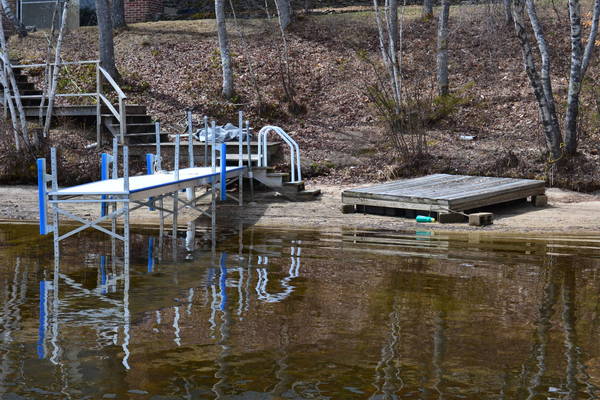
|
|
|
|
|
|
06-02-2013, 08:22 PM
|
#15 | |
|
Senior Member

Join Date: Apr 2004
Location: Belmont NH but prefer Jackman Maine
Posts: 1,857
Thanks: 491
Thanked 410 Times in 251 Posts
|
Quote:
__________________
"better to have a short life that is full of what you like doing, then a long life spent in a miserable way.."
|
|
|
|
|
|
06-03-2013, 08:25 AM
|
#16 |
|
Senior Member
Join Date: Apr 2004
Posts: 519
Thanks: 111
Thanked 259 Times in 107 Posts
|
The town turned the dam control over to the "Main Power Co." who has a generator on the dam. Or so I've been told. They don't know how to control the water level yet.
Once the marina's had to stop putting customer boats in due to low water they finally closed the gates down. They closed them so far that the Ossipee river was but a trickle from normal flow. It took about two weeks to get the level up. About a week before you could navigate the No-Wake zones with motor down. While I was there the "channel" at spindle point, and I mean "mid Channel" only had 1-1/2 feet of water. I had to run it with my engine up to the point that the prop was almost out of the water.. ToW |
|
|
|
|
06-03-2013, 08:46 AM
|
#17 | |
|
Senior Member
Join Date: Feb 2008
Location: Gilford, NH / Welch Island
Posts: 6,231
Thanks: 2,382
Thanked 5,276 Times in 2,050 Posts
|
Quote:
__________________
It's Always Sunny On Welch Island!! 
|
|
|
|
|
|
06-03-2013, 09:02 AM
|
#18 | |
|
Senior Member
Join Date: Apr 2004
Posts: 519
Thanks: 111
Thanked 259 Times in 107 Posts
|
Quote:
That's all I know but will check it out some more.. ToW |
|
|
|
|
|
06-03-2013, 09:12 AM
|
#19 | |
|
Senior Member
Join Date: Feb 2008
Location: Gilford, NH / Welch Island
Posts: 6,231
Thanks: 2,382
Thanked 5,276 Times in 2,050 Posts
|
Quote:
Thanks; Dan
__________________
It's Always Sunny On Welch Island!!
|
|
|
|
|
|
06-03-2013, 02:51 PM
|
#20 | |
|
Senior Member
Join Date: Apr 2004
Posts: 519
Thanks: 111
Thanked 259 Times in 107 Posts
|
Quote:
The first set of channel markers in Broad Bay heading towards the main lake is where it was so low. We have a new neighbor who bought a brand new Toon with a Merc 115 on it. I told them if they go out to be VERY careful due to the low water. I guess he wasn't because on his maiden voyage he took 1-1/2 inches off all three blades on his prop.  And yes it happened at Spindle Point. And yes it happened at Spindle Point.ToW |
|
|
|
|
|
06-03-2013, 03:22 PM
|
#21 | |
|
Senior Member
Join Date: Feb 2008
Location: Gilford, NH / Welch Island
Posts: 6,231
Thanks: 2,382
Thanked 5,276 Times in 2,050 Posts
|
Quote:
When you said "Spindle Point" I immediately thought Winni and I was trying to think how the heck the water could be low at Spindle Point and not at Welch Island!!  Anyway, when you mentioned Broad Bay the light came on! I also should of re-read your initial post where you mentioned the Ossipee's! Anyway, when you mentioned Broad Bay the light came on! I also should of re-read your initial post where you mentioned the Ossipee's! It must be time for my nap! Thanks! Dan
__________________
It's Always Sunny On Welch Island!!
|
|
|
|
|
|
06-03-2013, 04:10 PM
|
#22 | |
|
Senior Member
Join Date: Oct 2010
Posts: 2,028
Thanks: 603
Thanked 687 Times in 425 Posts
|
Quote:
There has been a lot of controversy about the height of the water at different times of the year.
__________________
It's never crowded along the extra mile. |
|
|
|
|
|
06-03-2013, 08:06 PM
|
#23 |
|
Senior Member

Join Date: Feb 2004
Location: Center Harbor
Posts: 1,164
Thanks: 205
Thanked 431 Times in 248 Posts
|
The original post complains the Lakeport dam is closed but this link http://www2.des.state.nh.us/RTi_Home...E=Lakeport+Dam shows the dam output has been regularly raised since May 26 and is currently over 1400 CFS which, I believe, means the flood gates have been opened to some extent. The lake is nowhere near being flooded, just a couple inches over "full" after some heavy downpours yesterday. If they keep pouring out the water at this rate it will drop the lake about an inch a day (I believe). At that rate the lake should be down to "full" level in a 3 to 5 days. That's hardly a big deal.
|

|
|
|
06-03-2013, 08:16 PM
|
#24 |
|
Senior Member
Join Date: Oct 2004
Location: Laconia NH
Posts: 5,570
Thanks: 3,205
Thanked 1,101 Times in 793 Posts
|
The weekend before, my slip was underwater. Last weekend it was fine. The dam operators do a good job at keeping the water under control.
The last time I saw my slip underwater was the Mother's Day flood of 2006. The slip was underwater for almost a month. I believe that was the time Silver Lake in Lochmere experience heavy flooding. It is a fine line to balance the flow between Lake Winnipesaukee and the Lakes down river.
__________________
Someday may never be an actual day. |
|
|
|
|
06-03-2013, 08:20 PM
|
#25 |
|
Senior Member
Join Date: Feb 2004
Location: Center Harbor
Posts: 1,164
Thanks: 205
Thanked 431 Times in 248 Posts
|
The flow is the amount of water leaving Lake Winnipesaukee at the Lakeport Dam. It is measured in cubic feet per second (CFS). To put this in perspective, 1920 CFS is enough to fill about 45 swimming pools each minute. For a period of 24 hours, 1920 CFS yields 1.24 billion gallons, or enough water to lower the level of Lake Winnipesaukee one inch. The flow fluctuates depending on the time of year and the lake's height. The long-term average is about 550 CFS.
So 1400 is not quite an inch drawdown per day. Of course there is additional run off after a big rain storm and the normal inflow sources that need to be balanced. However, at this rate it will come down in less than a week. And again, the dam is being actively managed and NOT "closed". |
|
|
|
|
06-05-2013, 07:16 AM
|
#26 | |
|
Senior Member
Join Date: Apr 2004
Posts: 519
Thanks: 111
Thanked 259 Times in 107 Posts
|
Quote:
I'm not local so I have to trust those who are. Me bad.  In any case the water was WAY to low for the time of year. ToW |
|
|
|
|
|
| Bookmarks |
|
|


 Linear Mode

