

|
|
|
|
|
|||||||
| Home | Forums | Gallery | Webcams | Blogs | YouTube Channel | Classifieds | Calendar | Register | FAQ | Donate | Members List | Today's Posts | Search |
 |
|
|
Thread Tools | Display Modes |
 10-15-2005, 04:36 PM
|
#1 |
|
Senior Member

Join Date: Apr 2004
Location: Lakes Region
Posts: 547
Thanks: 9
Thanked 29 Times in 20 Posts
|
well, it rained like crazy last night and all of today here in Moult. So far, 3+ inches in the rain gauge. the lake is very high, similar to June levels with the dock at my place actually now submerged which only happens in June. two little streams adjacent to the property are flowing vary rapidly. the rain is begining to taper off, at the same time the wind is starting to pick up. Approximately 10 inches of rain has fallen since a week ago!
Someone's water craft washed up on shore, having broken loose from its mooring (i have already contacted its owner and it is OK and secure, so unless I called you, its not yours!) lots of washouts in the dirt roads of the area, but all in all, it looks like Moultonboro is OK from my vantage point in upper Moult Bay. Lots of debris floating around in the lake, so if you are boating, watch out. Looking forward to Sunday and drying out (I hope) |

|

|
|
10-15-2005, 05:36 PM
|
#2 |
|
Senior Member

Join Date: Apr 2004
Location: Gilford year round, West Alton summers
Posts: 582
Thanks: 580
Thanked 194 Times in 99 Posts
|
Still raining pretty heavily here on Rt. 11A. Some washout on the sides of roads. The stream along Rt. 11B is VERY high and flooding a few yards side leading down to Rt. 11A due to some road damage/washout.
Our next door neighboors have 2 new streams cutting through their yard, and we have one as well. Nothing damaging, but just the rushing water taking the path of least resistence. The wind is whipping up pretty nicely...I heard a very strong gust at about 6:30 pm. Glad we took down a bunch of trees on the property a while back...especially when we get strong winds/gusts. Looking forward to some sunshine sometime during the Fall.... Stay safe, all --- Gravy |
|
|
|
|
10-15-2005, 06:06 PM
|
#3 |
|
Senior Member

Join Date: Jul 2002
Location: Rock Haven Lake - West Newfield, ME
Posts: 5,361
Thanks: 374
Thanked 1,044 Times in 490 Posts
|
It's been pouring all day. My little lake is two feet higher than I've ever seen it before! My dock would be underwater except it has floated away! (and is caught on some branches a ways down the lake!) I'd post a photo but I'm on this slow modem up at the lake. Now the wind is picking up and the power is flickering off and on ...I guess I should sign off!
|
|
|
|
|
10-15-2005, 07:35 PM
|
#4 |
|
Senior Member

Join Date: Sep 2003
Location: Gilmanton, NH
Posts: 754
Thanks: 136
Thanked 92 Times in 51 Posts
|
Many docks by Zack's on Winnisquam are under water (some with boats tied to them)
 I checked on my boat this afternoon and couldn't believe how high the lake has risen in the past 10 days, especially considering the dam outflow. Looks like we get to deal with 50 mph winds now I checked on my boat this afternoon and couldn't believe how high the lake has risen in the past 10 days, especially considering the dam outflow. Looks like we get to deal with 50 mph winds now ")
Last edited by Paugus Bay Resident; 10-15-2005 at 09:02 PM. |
|
|
|
|
10-15-2005, 07:52 PM
|
#5 |
|
Senior Member

Join Date: Apr 2004
Location: Westford, MA and Alton Bay, NH
Posts: 225
Thanks: 0
Thanked 0 Times in 0 Posts
|
I have to admit as horrible as I feel about your post McDude...... It made me giggle!
I hope that you get it back and that all works out well
__________________
Wendy "Wasn't Me!" |
|
|
|
| Sponsored Links |
|
|
|
10-15-2005, 08:47 PM
|
#6 |
|
Member
Join Date: Oct 2005
Posts: 20
Thanks: 0
Thanked 23 Times in 1 Post
|
50 mph winds!
If anyone has any pics of the lake in this condition, it would be nice to see them (as well as tomorrow's windy day pics). I haven't been to the lake in over a month, and I'm interested to see how it looks in the aftermath of this rain/windstorm.
|
|
|
|
|
10-15-2005, 09:45 PM
|
#7 |
|
Senior Member
Join Date: Sep 2003
Location: Gilmanton, NH
Posts: 754
Thanks: 136
Thanked 92 Times in 51 Posts
|
JK47, I'll try to take some tomorrow
|
|
|
|
|
10-15-2005, 10:00 PM
|
#8 |
|
Senior Member
Join Date: Sep 2003
Location: Gilmanton, NH
Posts: 754
Thanks: 136
Thanked 92 Times in 51 Posts
|
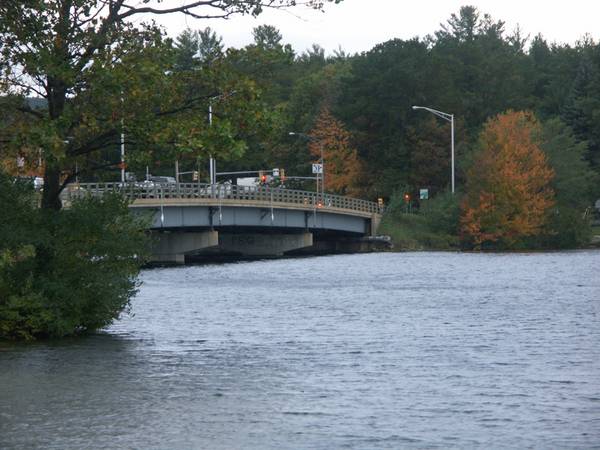
Just heard (11pm) that the state is now sand bagging the top of the Lakeport dam to slow down the flow into Winnisquam and the Winni river. When I drove over the Mosquito bridge tonight I was amazed how high Winnisquam was. Lots of high water on Rt 3. Everyone stay safe.
Last edited by Paugus Bay Resident; 10-15-2005 at 10:02 PM. |
|
|
|
|
10-15-2005, 10:36 PM
|
#9 | |
|
Senior Member

Join Date: Jul 2002
Location: Massachusetts
Posts: 332
Thanks: 0
Thanked 242 Times in 81 Posts
|
Quote:
|
|
|
|
|
|
10-15-2005, 10:38 PM
|
#10 |
|
Senior Member
Join Date: Apr 2004
Location: Suncook, NH, but at The Lake at Heart
Posts: 2,612
Thanks: 1,082
Thanked 433 Times in 209 Posts
|
Channel 9 reported the lake could rise as much as 1 ft over the normal summer level. This could add a lot of debris from the shore into the lake. Hopefully not to much.
McD better get the Kayak out to tow the dock home! 
__________________
Just Sold  At the lake the stress of daily life just melts away. Pro Re Nata |
|
|
|
|
10-15-2005, 10:43 PM
|
#11 |
|
Senior Member
Join Date: Sep 2003
Location: Gilmanton, NH
Posts: 754
Thanks: 136
Thanked 92 Times in 51 Posts
|
Just reporting what I heard (Ch 9). I'll go down tomorrow morning to see for myself. Channel 9 is also reporting that the state said Winnipesaukee will likely rise to a level at least 1 foot above normal summer levels. Things can change very quickly. I assume they know what they're doing
|
|
|
|
|
10-15-2005, 11:15 PM
|
#12 | |
|
Member
Join Date: Oct 2005
Posts: 20
Thanks: 0
Thanked 23 Times in 1 Post
|
Quote:

|
|
|
|
|
|
10-16-2005, 06:30 AM
|
#13 |
|
Senior Member

Join Date: Jan 2005
Location: Florida (Sebring & Keys), Wolfeboro
Posts: 5,788
Thanks: 2,085
Thanked 742 Times in 532 Posts
|
Still hoping for one more sunny day of sailing, so my boat's still in the water.
Although I checked my boat at the dock at sundown, it started banging the dock at midnight. The water level at midnight was higher than it was in May! Lots of debris on and in the muddy water, too. I don't recall an October like this of late. |
|
|
|
|
10-16-2005, 07:01 AM
|
#14 |
|
Senior Member

Join Date: Jul 2002
Location: Central MA
Posts: 2,352
Thanks: 18
Thanked 535 Times in 179 Posts
|
Thanks for the frequent updates to your lake levels page this week. It helps a lot to see what is going on.
__________________
Island Girl ....... Make Lemonade |
|
|
|
|
10-16-2005, 07:16 AM
|
#15 |
|
Senior Member
Join Date: Jul 2002
Location: Massachusetts
Posts: 332
Thanks: 0
Thanked 242 Times in 81 Posts
|
While Winnipesaukee & Winnisquam have risen about 20", Silver Lake (just downstream from Winnisquam) is up 74" in 10 days. I'm guesing that the TV station just announced the wrong dam. The flow at the Lakeport dam has been cut back from 2000 Cubic Feet per Second (CFS) to about 700 CFS. This is probably to reduce levels downstream. The flow at the Tilton dam (below Silver lake) is now over 4000 CFS, about 5 times normal.

|
|
|
|
|
10-16-2005, 07:34 AM
|
#16 |
|
Senior Member
Join Date: Jul 2002
Location: Central MA
Posts: 2,352
Thanks: 18
Thanked 535 Times in 179 Posts
|
Kevin Sperl/Staff Photo Not since 1984 has conditions warranted the sandbagging of the Lakeport Dam. With the levels of Lake Winnipesaukee reaching its maximum, Laconia Fire, Police and Public Works personnel fill and place sandbags around the top of the Lakeport Dam to gain another couple of feet of rising water.
__________________
Island Girl ....... Make Lemonade |
|
|
|
|
10-16-2005, 08:51 AM
|
#17 |
|
Senior Member
Join Date: Jul 2002
Location: Rock Haven Lake - West Newfield, ME
Posts: 5,361
Thanks: 374
Thanked 1,044 Times in 490 Posts
|
Wendy: We've been chuckling about this ourselves! Overnight the dock has miraculously floated back over in front of the cottage. Time to get out in the kayak and tie it to a tree or something as JustSold has suggested.
 Very windy out there! The foliage is actually peaking around here. Would be very nice if the weather weren't so gloomy! Very windy out there! The foliage is actually peaking around here. Would be very nice if the weather weren't so gloomy!
|
|
|
|
|
10-16-2005, 09:29 AM
|
#18 |
|
Senior Member
Join Date: Jul 2002
Location: Massachusetts
Posts: 332
Thanks: 0
Thanked 242 Times in 81 Posts
|
I guess there ARE sandbagging the Lakeport dam. I apologize for doubting PBR. (Actually, I though it was the TV station that goofed). However, the lake is still 13" below the 1984 level and 9" below the 1998 level (when they didn't use sandbags). I don't understand their use. Perhaps they are anticipating a large runoff from the hills over the next few days. FYI: As of 10:30, the lake is at 4.74, down a tad from the 7am reading of 4.75 (so it is not rising).
If anyone is going by the dam today, I'd like to find out how high the dam is above the current lake level. |
|
|
|
|
10-16-2005, 12:00 PM
|
#19 | |
|
Senior Member
Join Date: Apr 2004
Posts: 1,325
Thanks: 5
Thanked 0 Times in 0 Posts
|
everyone posted to the same Lake Level thread; rather than creating new threads because of ?????
This from an earlier thread regarding the Lake Level provides some interesting info: Quote:
http://www.wunderground.com/weathers...p?ID=KNHGILFO3 Last edited by GWC...; 10-16-2005 at 01:28 PM. |
|
|
|
|
|
10-16-2005, 12:12 PM
|
#20 |
|
Senior Member

Join Date: Jul 2005
Location: Berlin, Ma / Gilford
Posts: 1,931
Thanks: 445
Thanked 604 Times in 340 Posts
|
Does anyone have a map or link that they could post showing the route/path that water leaving Lakeport Dam takes ??
|
|
|
|
|
10-16-2005, 01:14 PM
|
#21 |
|
Senior Member

Join Date: Apr 2004
Location: North Shore, MA
Posts: 1,352
Thanks: 987
Thanked 310 Times in 161 Posts
|
Phantom,
Although I do not have a map, the last of the three web sites in the post highlighted above your post shows some detail. The water goes through the Lakeport Dam into Lake Winnisquam. From Lake Winnisquam it goes into Silver Lake and then into the Winnipesaukee River. You can see the flow on the Winnipesaukee River near Exit 20 of I-93. The Winnipesaukee River dumps into the Merrimac. The problem is if the level of Lake Winnipesaukee was to be lower by increasing the water through the Lakeport Dam while the down stream lakes and rivers are already high and in some cases in flood, There would be a bigger problem. Silver lake is up over 6 feet in the last 10 days as it is. The folks that operate the dam do a great job of keeping the right amount of water in Lake Winnipesaukee while doing their best to moderate down stream problems. I hope this helps. |
|
|
|
|
10-16-2005, 01:27 PM
|
#22 |
|
Senior Member
Join Date: Apr 2004
Posts: 1,325
Thanks: 5
Thanked 0 Times in 0 Posts
|
|
|
|
|
|
10-16-2005, 05:27 PM
|
#23 |
|
Senior Member
Join Date: Jul 2002
Location: Rock Haven Lake - West Newfield, ME
Posts: 5,361
Thanks: 374
Thanked 1,044 Times in 490 Posts
|
I've uploaded a few photos of all the water and rain up in my neck of the woods. CHECK IT OUT

|
|
|
|
|
10-16-2005, 06:15 PM
|
#24 |
|
Senior Member
Join Date: Jul 2002
Location: Central MA
Posts: 2,352
Thanks: 18
Thanked 535 Times in 179 Posts
|
Incredible amounts of water. Nice job, McD.
__________________
Island Girl ....... Make Lemonade |
|
|
|
|
10-16-2005, 06:46 PM
|
#25 |
|
Senior Member

Join Date: Nov 2003
Location: Central NH
Posts: 5,252
Blog Entries: 1
Thanks: 1,447
Thanked 1,349 Times in 475 Posts
|
Thanks for taking the time for the photos. Very dramatic.
I'm glad your dock came back to you!  Isn't this the dock that floated away last winter? I thought you fixed it. Isn't this the dock that floated away last winter? I thought you fixed it.
|
|
|
|
|
10-16-2005, 07:11 PM
|
#26 |
|
Senior Member
Join Date: Jul 2002
Location: Rock Haven Lake - West Newfield, ME
Posts: 5,361
Thanks: 374
Thanked 1,044 Times in 490 Posts
|
Thanks for pointing that out, RG! As you can see I did not do such a great job! 
|
|
|
|
|
10-16-2005, 07:15 PM
|
#27 | |
|
Senior Member
Join Date: Jul 2002
Location: Massachusetts
Posts: 332
Thanks: 0
Thanked 242 Times in 81 Posts
|
Quote:
The water drops about 12 feet into Opechee Lake thence passes through downtown Laconia into Winnisquam. It flows under route 3 at Mosquito Bridge which is at Winnisquam Marina. The river stays on the south side of Route 3 all the way to Franklin as depicted on the attached map. (about 9 miles from corner to corner).  In Franklin it merges with the Pemigewasset river to form the Merrimac river and turns south to Concord, Hooksett, Manchester, Nashua, and Lowell. It leaves US-3 and turns east to Lawrence, Haverhill and the Atlantic Ocean. Last edited by Bizer; 10-17-2005 at 07:14 AM. |
|
|
|
|
|
10-16-2005, 07:54 PM
|
#28 | |
|
Senior Member
Join Date: Nov 2003
Location: Central NH
Posts: 5,252
Blog Entries: 1
Thanks: 1,447
Thanked 1,349 Times in 475 Posts
|
Quote:
|
|
|
|
|
|
10-17-2005, 06:36 AM
|
#29 |
|
Senior Member
Join Date: Jul 2005
Location: Berlin, Ma / Gilford
Posts: 1,931
Thanks: 445
Thanked 604 Times in 340 Posts
|
Thanks all for the maps
|
|
|
|
|
10-17-2005, 06:28 PM
|
#30 |
|
Senior Member

Join Date: Apr 2003
Location: Massachusetts & Moultonborough
Posts: 673
Thanks: 41
Thanked 15 Times in 11 Posts
|
neat photos McDude. We're sure hoping our canoe was far enough away from the shoreline. Going up this week to close down camp. Hoping for good weather.
__________________
Lin |
|
|
|
|
| Bookmarks |
|
|


 Linear Mode

