Home Forums Gallery Webcams Blogs YouTube Channel Classifieds Calendar Register FAQDonate Members List Today's Posts

  Home · Search · Register  

Home » Member Galleries » dcr Previous image   Slide Show   Next image
more
Smith_Cove3.jpg
Washington_from_Smith_Cove2.jpg
Belknap_Motel_pan2.jpg
Lake_Waukewan2.jpg
robin_3.jpg
more

Belknap Point Rd Panorama
Click on image to view larger image


Photo Details
dcr


Deceased Member

Registered: February 2004
Posts: 1,317
users gallery
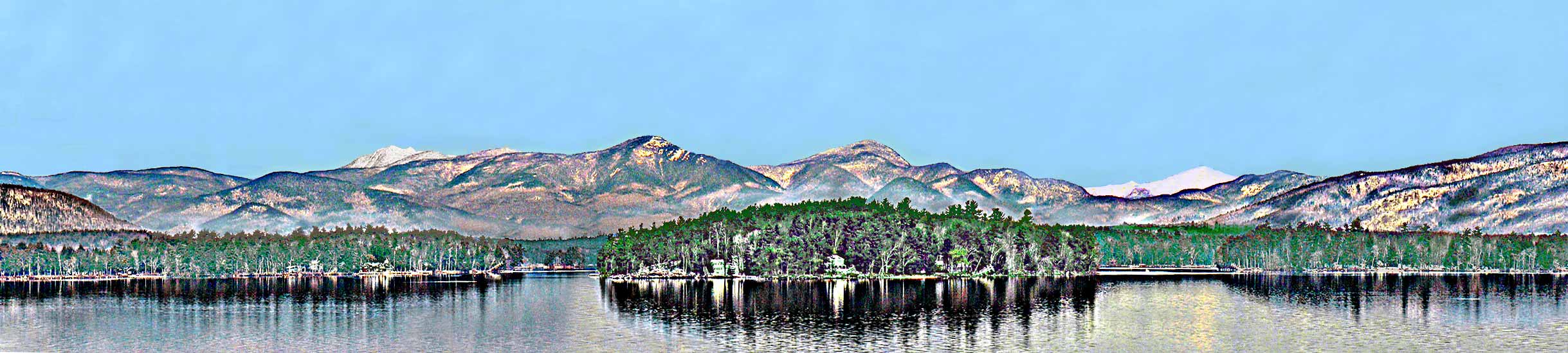
From below the Belknap Point Motel. The range most represented here is the Sandwich Range, starting with Flat Mt at the far left and going to Mt Paugus near the far right (part of the Ossipee Range is at the extreme right). At left center is seen snow-capped Mt Tripyramid, while at right center is snowy Mt Washington, about 50 miles distant. Note that the waters of The Broads are still ice-free.
· Date: Thu December 29, 2005 · Views: 3954 · Filesize: 15.9kb, 185.8kb · Dimensions: 2438 x 550 ·
Additional Info
Print View
Linked Thumbnail:  more


Photo Sharing Gallery by PhotoPost
Copyright © 2007 All Enthusiast, Inc.


All times are GMT -5. The time now is 08:40 PM.


Powered by vBulletin® Version 3.8.11
Copyright ©2000 - 2025, vBulletin Solutions Inc.