Home Forums Gallery Webcams Blogs YouTube Channel Classifieds Calendar Register FAQDonate Members List Today's Posts

  Home · Search · Register  

Home » Member Galleries » dcr Previous image   Slide Show   Next image
more
Wash_from_Belknap_Pt_2.jpg
Ossipees_from_Belknap_Pt_2.jpg
Tripy_etc_from_Belknap_Pt2.jpg
Fields_Brook_cascade_2.jpg
Sand_Dome_from_Ledgewood2.jpg
more

Sandwich Range from Belknap Point Rd
Click on image to view larger image


Photo Details
dcr


Deceased Member

Registered: February 2004
Posts: 1,317
users gallery
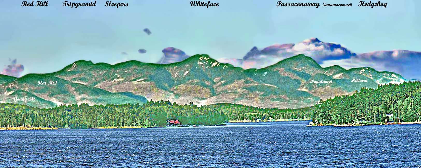
Looking past the Forty Islands (Round Is to the right and Mink, Mark and E. Bear Is to the left) we see Tripyramid, Whiteface and Passaconaway Mts of the Sandwich Range. They occupy most of the central portion of the photo. Flat Mt is at the far left and Mt Hedgehog at the far right. Between Whiteface (dead center) and Passaconaway to its right is a deep ravine called The Bowl, which is a specially designated wilderness study area of the WMNF.
· Date: Wed December 14, 2005 · Views: 2103 · Filesize: 32.0kb, 200.5kb · Dimensions: 1625 x 650 ·
Additional Info
Print View
Linked Thumbnail:  more


Photo Sharing Gallery by PhotoPost
Copyright © 2007 All Enthusiast, Inc.


All times are GMT -5. The time now is 02:02 PM.


Powered by vBulletin® Version 3.8.11
Copyright ©2000 - 2025, vBulletin Solutions Inc.