dcr
Deceased Member
Registered: February 2004
Posts: 1,317

|
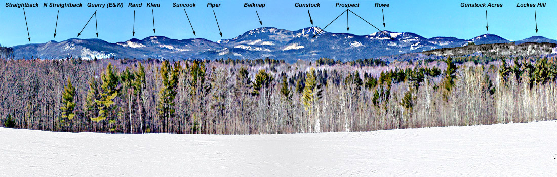
As this may be confusing, some explanation follows: Quarry Mt is a fairly long mountain,running SW to NE, with 2 summits of near-equal height at the extreme ends; Piper Mt is a long mountain at the W end of the range, only a small part of which shows here, in a dip between Suncook and Belknap Mts; Prospect Mt is an even longer mountain, running nearly N and S (a lakeside mountain whose E slopes run down to Winnipesaukee - Diamond, Rattlesnake and Sleepers are due east of it), which doesn't show up well here because its N and S peaks blend into the lower slopes of Gunstock and Rowe, but its middle peak does show on the skyline between those two mountains; Gunstock Acres is not an actual name, but a try at identifying an unnamed map feature with something people know from the real world - some of Gunstock Acres is on this mountain and some is on the northern slopes of Prospect Mt. Rowe is easily identified by the huge cell-tower on it (not seen here). I hope this helps more than it may tend to confuse. McDude, from this angle Major, out of the pic just left of Straightback, is obscured by trees. By the way, IG, a considerable portion of Rattlesnake Island shows in the left-center of the photo (altho not easy to make out).
|


 Winnipesaukee Forum