Winnipesaukee Forum
User Name
Remember Me?
Password
Home
Forums
Gallery
Webcams
Blogs
YouTube Channel
Classifieds
Calendar
Register
FAQ
Donate
Members List
Today's Posts
Search
Community Links
Social Groups
Search Forums
Show Threads
Show Posts
Advanced Search
Find All Thanked Posts
Search Blogs
Tag Search
Advanced Search
Go to Page...
Home
·
Search
·
Register
Home
»
Historical Photographs
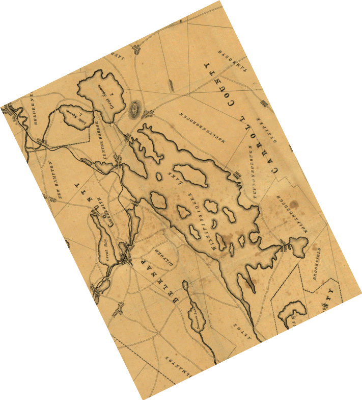
1845 Winnipesaukee RR Map
Click on image to view smaller image
Photo Details
Rattlesnake Gal
Senior Member
Registered: November 2003
Location: Central NH
Posts: 5,252
1845 Lake Winnipesaukee rail road map. Map is crooked because it was drawn with north in the wrong direction.
·
Date:
Sat August 14, 2004 ·
Views:
4578 ·
Filesize:
32.0kb
,
177.7kb
·
Dimensions:
711 x 784 ·
Additional Info
Linked Thumbnail:
HTML code:
Direct link:
Photo Sharing Gallery by PhotoPost
Copyright © 2007 All Enthusiast, Inc.
All times are GMT -5. The time now is
02:40 PM
.
Contact Us
-
www.winnipesaukee.com
-
Archive
-
Top
Powered by vBulletin® Version 3.8.11
Copyright ©2000 - 2024, vBulletin Solutions Inc.


 Winnipesaukee Forum


