Home Forums Gallery Webcams Blogs YouTube Channel Classifieds Calendar Register FAQDonate Members List Today's Posts

  Home · Search · Register  

Home » Historical Photographs Previous image   Slide Show   Next image
more
176Thomas_Plant_Spite_Fence.jpg
ApSBenthicWinnipesaukeeScientist.gif
1885map.jpg
176Camp_Ossipee.jpg
Wolfeboro_RR_Plymouth_switcher.jpg
more

1885map
1885 Boston to Lowell Railroad - Lake Winnipesaukee
Click on image to view smaller image


Photo Details
Bear Island South


Senior Member

Registered: April 2008
Location: Southboro, MA
Posts: 579
users gallery
· Date: Sat April 10, 2010 · Views: 7148 · Filesize: 32.0kb, 1498.6kb · Dimensions: 2083 x 2171 ·
Additional Info
Print View
Linked Thumbnail:  more


Author
Thread  
mcdude

Senior Member

Registered: July 2002
Location: Rock Haven Lake - West Newfield, ME
Posts: 5,361
Sat April 10, 2010 4:33pm

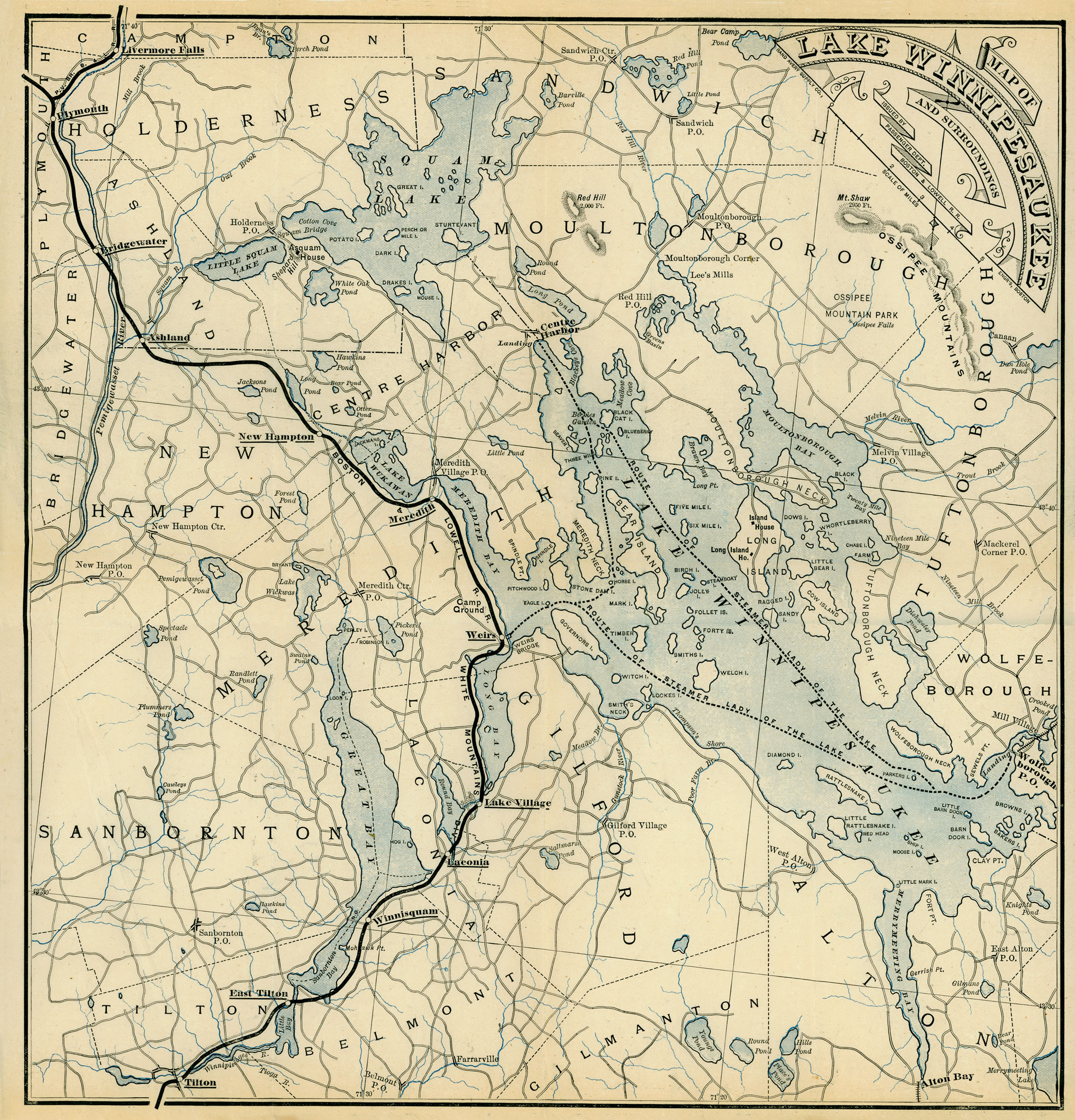
Thanks for posting! I love this map because it even shows my little pond located just below and to the right of the "N" in Gilmanton. Note that in 1885 the Lakeshore RR was only completed as far as Alton and had not continued up the lake yet. The Alton to Laconia line did not open until 1890.

------------------------------

This user is offline
Click here to see this users profile Click here to Send this user a Private Message Find more posts by this user Visit this user's gallery  
Rattlesnake Gal

Senior Member

Registered: November 2003
Location: Central NH
Posts: 5,252
Wed May 5, 2010 8:24pm

The Witches were still listed as an island! Excellent map - thank you for posting it.
This user is offline
Click here to see this users profile Click here to Send this user a Private Message Visit Rattlesnake Gal's homepage! Find more posts by this user Visit this user's gallery  


Photo Sharing Gallery by PhotoPost
Copyright © 2007 All Enthusiast, Inc.


All times are GMT -5. The time now is 04:10 PM.


Powered by vBulletin® Version 3.8.11
Copyright ©2000 - 2024, vBulletin Solutions Inc.