dcr
Deceased Member
Registered: February 2004
Posts: 1,317

|
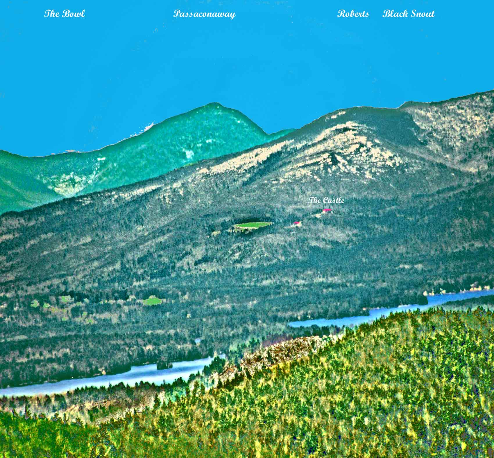
View NNW. Local Cedar Mt is at the bottom right. A little of the high ground of Rattlesnake Island is seen a little behind Cedar. Parts of Moultonboro Bay run thru the lower part of the photo. Below Mt Roberts you can see the red roofs of the Castle and the Carriage House at Castle in the Clouds. In the right mid-ground are Mt Roberts and Black Snout of the Ossipees. At the back left-center is Mt Passaconaway of the Sandwich Range - to its left is The Bowl, a deep glacial cirque cut into the ridge joining Passaconaway and Whiteface (not visible)Mts during the last ice age.
|


 Winnipesaukee Forum