Registered: December 2006 Location: Weirs Beach Posts: 97
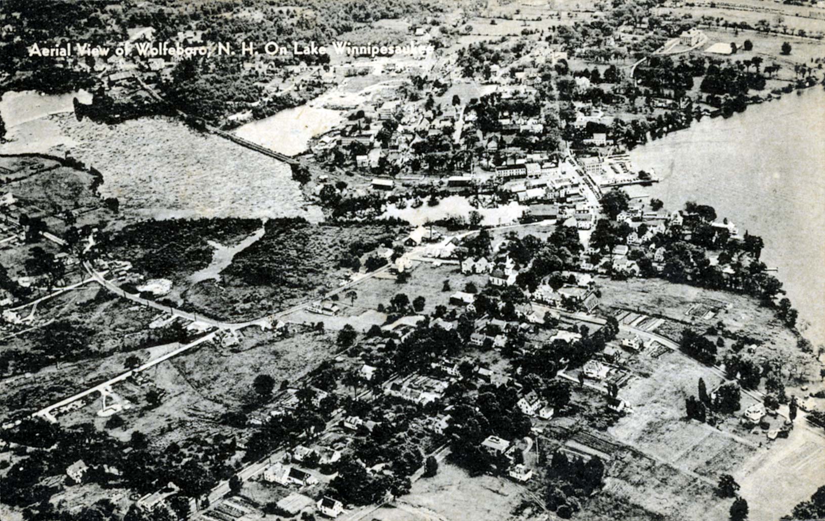
Photo by Merwin and Eleanor Horn. Published by Gould's Dime Store, Wolfeboro, N.H.
· Date: Sun March 11, 2007 · Views: 7529 · Filesize:32.0kb, 345.4kb · Dimensions: 1631 x 1031 ·
Additional Info
Linked Thumbnail:
HTML code: Direct link:
Author
Thread
mcdude Senior Member
Registered: July 2002 Location: Rock Haven Lake - West Newfield, ME Posts: 5,359
Sun March 11, 2007 7:03pm
In this card you can clearly see Front Bay and Back Bay before Back Bay was filled in. Back Bay is seen behind (above) the RR tracks and was the area behind DeVylder's Grocery Store. Also note that Front Bay is filled with logs that have been floated down the river for the Berry Company and Clow's Mill to work with. Some believe that it is the sediment from these logs which is still lying on the bottom of the bay that encourages all the milfoil growth in the area.


 Winnipesaukee Forum