Home Forums Gallery Webcams Blogs YouTube Channel Classifieds Calendar Register FAQDonate Members List Today's Posts

  Home · Search · Register  

Home » Scenic Views » Aerial Views Previous image   Slide Show   Next image
more
Akwa_11AsW.jpg
Maze2AsW.jpg
Pano1000sW.jpg
DSC_0107.JPG
DSC05865-1024w-rubberraft.jpg
more

Presidential Range
Click on image to view larger image


Photo Details
flyguy


Senior Member

Registered: December 2003
Location: Laconia NH
Posts: 383
users gallery
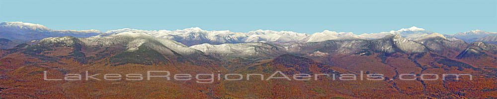
This panorama is a composite of 10 aerial photos taken from an altitude of ~5,000' over Center Sandwich in fall 2005. Mt. Washington is at right, Waterville Valley at left.
· Date: Thu November 17, 2005 · Views: 8027 · Filesize: 17.9kb, 138.8kb · Dimensions: 1000 x 200 ·
Additional Info
Print View
Linked Thumbnail:  more


Photo Sharing Gallery by PhotoPost
Copyright © 2007 All Enthusiast, Inc.


All times are GMT -5. The time now is 07:31 PM.


Powered by vBulletin® Version 3.8.11
Copyright ©2000 - 2025, vBulletin Solutions Inc.