dcr
Deceased Member
Registered: February 2004
Posts: 1,317

|
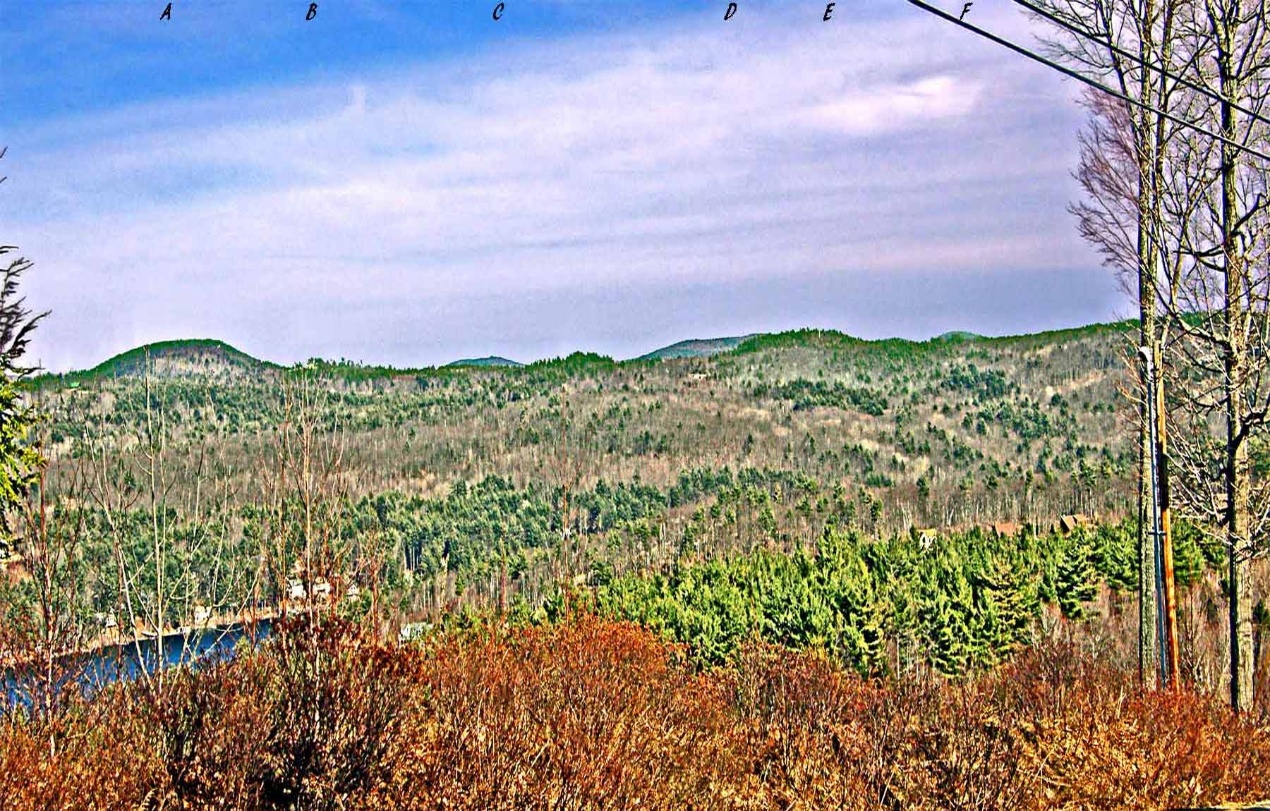
Using the letters across the top: Below A is Mt Bet, which lies at the NW shore of Merrymeeting Lake; B shows a house atop a high ridge near Bear Pond, but I resized the photo too much and it's now difficult to see; C shows Mt Jesse, at the easternmost end of Merrymeeting; D shows Birch Ridge, which takes up much of the SE shoreline of Merrymeeting; E shows a communication tower (cell?) on high hill on the horizon (beside the Old Wolfeboro Rd); and F shows Mt Eleanor, which drops down steeply to the southern shore of Merrymeeting Lake. When you look at Birch Ridge (D), you are looking due east. At the lower left you see part of Alton Bay, just N of Sandy Point. Thru the center of the photo are the roofs and upper stories of houses along the Lake/Woods development road on Rand Hill at Alton Bay.
|


 Winnipesaukee Forum