Home Forums Gallery Webcams Blogs YouTube Channel Classifieds Calendar Register FAQDonate Members List Today's Posts

  Home · Search · Register  

Home » Scenic Views Previous image   Slide Show   Next image
more
20scanoldaltonbaybridge.jpg
IMG_8882_copy.jpg
Shaw_-_cloud_topped_2.jpg
130dsc00008.jpg
100_7656.JPG
more

Cloud-topped Mt Shaw
Click on image to view larger image


Photo Details
dcr


Deceased Member

Registered: February 2004
Posts: 1,317
users gallery
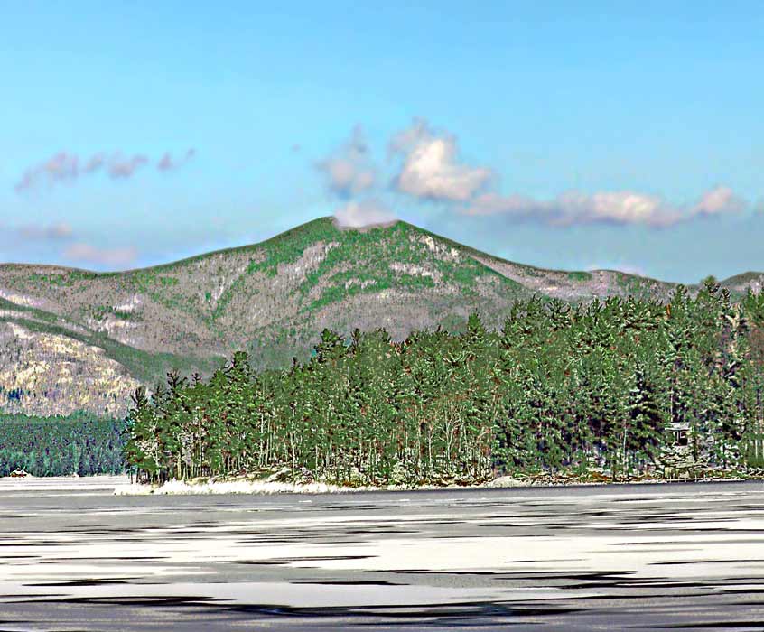
Photo recently from Rt 11 near Alton-Gilford line, during the period of the big freeze that really speeded up the ice-in process. I noticed a small cloud that hung stubbornly to the top of Mt Shaw and stopped for a picture. This was also shortly after the advent of the big winds that ushered in the cold snap - notice how lots of newly forming ice had been blown up against the northerly shores of Diamond Island and piled up to some depth. The top of Mt Flagg sneaks into the picture at the far right.
· Date: Sat January 27, 2007 · Views: 6324 · Filesize: 32.0kb, 83.8kb · Dimensions: 846 x 700 ·
Additional Info
Print View
Linked Thumbnail:  more


Photo Sharing Gallery by PhotoPost
Copyright © 2007 All Enthusiast, Inc.


All times are GMT -5. The time now is 04:14 AM.


Powered by vBulletin® Version 3.8.11
Copyright ©2000 - 2025, vBulletin Solutions Inc.