Winnipesaukee Forum
User Name
Remember Me?
Password
Home
Forums
Gallery
Webcams
Blogs
YouTube Channel
Classifieds
Register
FAQ
Members List
Donate
Today's Posts
Search
Community Links
Social Groups
Search Forums
Show Threads
Show Posts
Advanced Search
Find All Thanked Posts
Search Blogs
Tag Search
Advanced Search
Go to Page...
Home
·
Search
·
Register
Home
»
Miscellaneous
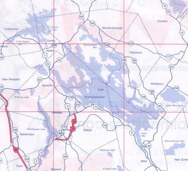
Lake Map with Town Boundaries
Click on image to view larger image
Photo Details
Rattlesnake Gal
Senior Member
Registered: November 2003
Location: Central NH
Posts: 5,253
Lake Winnipesaukee map with Town Boundaries.
http://www.winnipesaukee.com/forums/...ead.php?t=1629
Taken from the 2000 Universal Atlas os Southern NH with the Lakes Region.
·
Date:
Wed March 9, 2005 ·
Views:
5908 ·
Filesize:
32.0kb
,
744.4kb
·
Dimensions:
1200 x 1094 ·
Additional Info
Linked Thumbnail:
Linked Medium:
Medium Image:
HTML code:
Direct link:
Photo Sharing Gallery by PhotoPost
Copyright © 2007 All Enthusiast, Inc.
All times are GMT -4. The time now is
06:03 AM
.
Contact Us
-
www.winnipesaukee.com
-
Archive
-
Top
Powered by vBulletin® Version 3.8.11
Copyright ©2000 - 2026, vBulletin Solutions Inc.


 Winnipesaukee Forum