Quote:
Originally Posted by whalley1

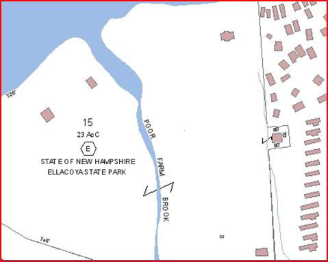
I went to the Gilford tax map and the amount of land on the water side of route 11 that the Park actually uses is only 23 acres. According to the state website the land on the opposite side would be very difficult to develop for campsites. Unfortunately the size of the map file is to large to post.
Here is a link for the map. You can zoom in to it and it will give acres. http://www.mapsonline.net/gilfordnh/ |
Here is your map. (from Town map)
Note LSP property is on the right, the small blocked off area halfway down the line between LSP and Ellacoya is the state sewer pumping station.
__________________
"Before you criticize someone, walk a mile in his shoes. That way, if he gets angry he'll be a mile away and barefoot!" unknown
|