I was browsing through my copy of The Gunstock Parish, by Adair Mulligan and I found the answer to the question I have had for a while now about why a pond in Gilford bears the name of Saltmarsh Pond. The following map is why I thought about it.
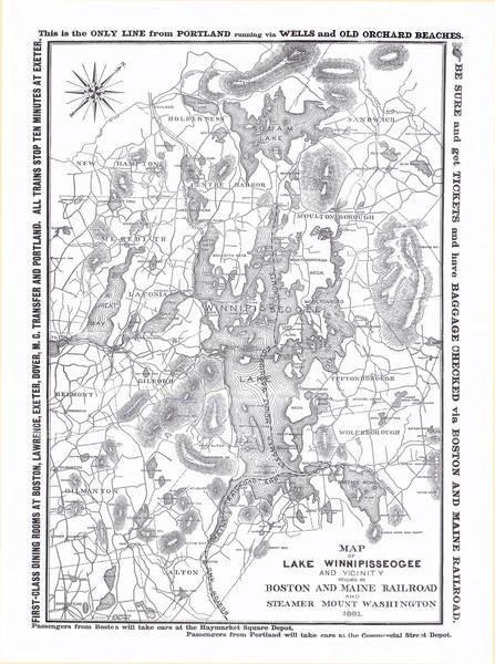
To Gallery for the full sized map:
1881 B & M Map of Lake Winnipiseogee and Vicinity
(Click on photo to enlarge)
Excerpt from the book: Gilford has only three natural ponds beyond what the beavers and bulldozers provide. Saltmarsh Pond, first known as Chattleborough Pond, drains into Jewett Brook and was named first for Thomas Chattle, who owned property nearby, and then for Thomas Saltmarsh, one of the town's first selectmen who farmed there. Lily Pond and it's associated wetlands, once known for their moose and water lilies, are the source of Black Brook, which flows into Paugus Bay. A hidden jewel of Gilford is Round Pond, protected in a high valley beneath Belknap and Piper mountains near the Gilmanton line. Once called Suncook Ponds, it is one of the sources of the Suncook River, which flows south into the Merrimack.
The following is a close up of Saltmarsh Pond, taken from an 1859 map of Gilford.